We work with civil engineering firms to ensure the pre-construction phase is done more affordable without impacting quality. Our curated in-house team of civil engineers, GIS specialists, and Landscape Designers design so you don’t have to.
We use proprietary aerial data as a starting point instead of satellite data from Bing or Google in most CAD/BIM/GIS platforms. This ensures the designs are more recent, georeferenced correctly, and accurate, so you won’t need to redo the design after the survey.
Your design team when you’re strapped on time and resources.
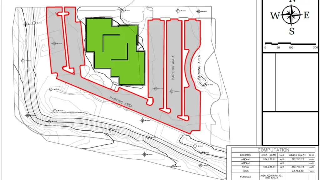
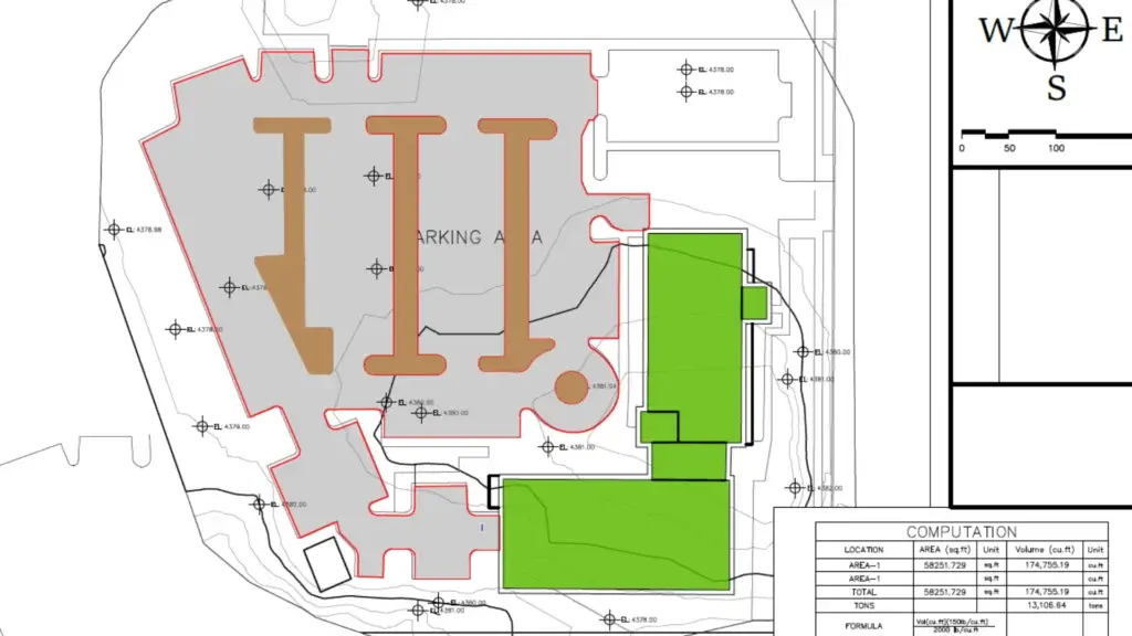
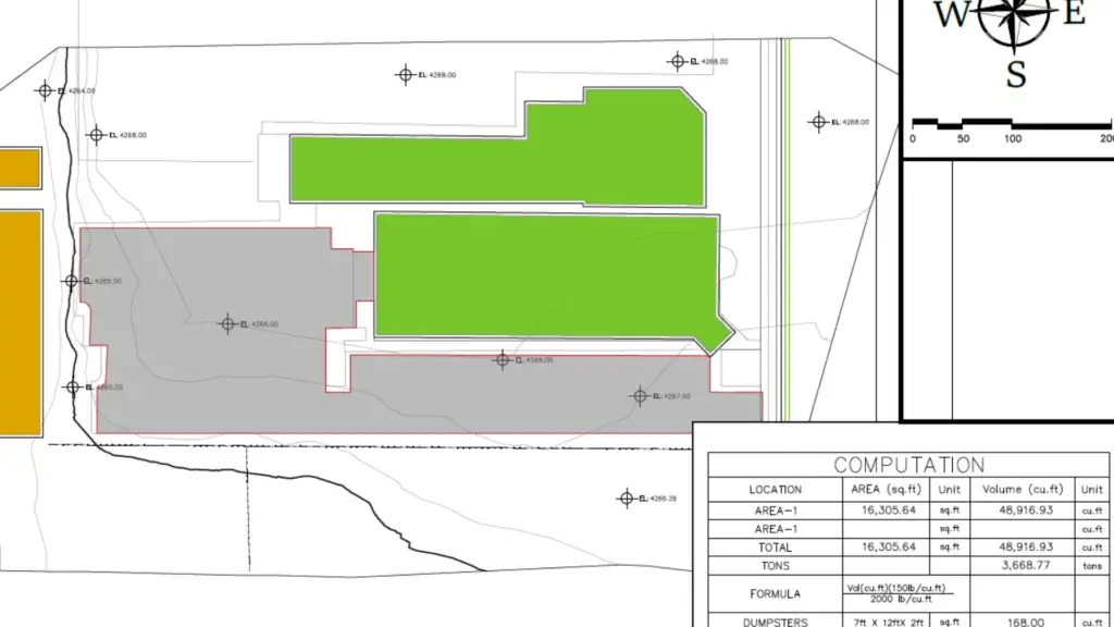
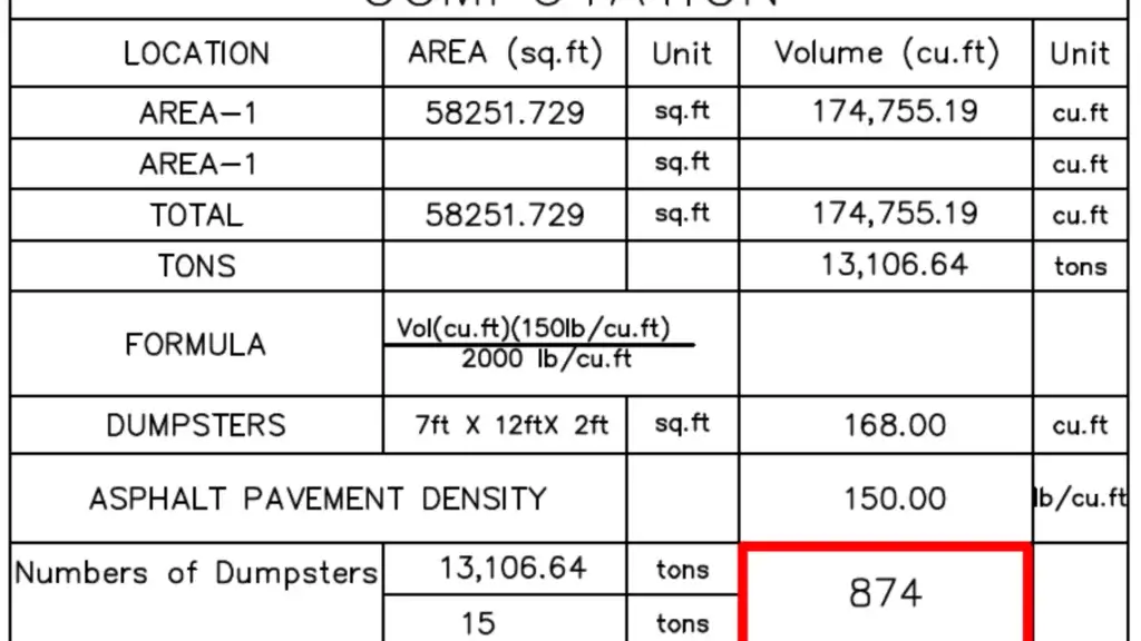
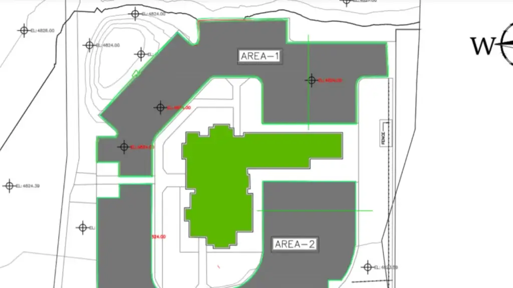
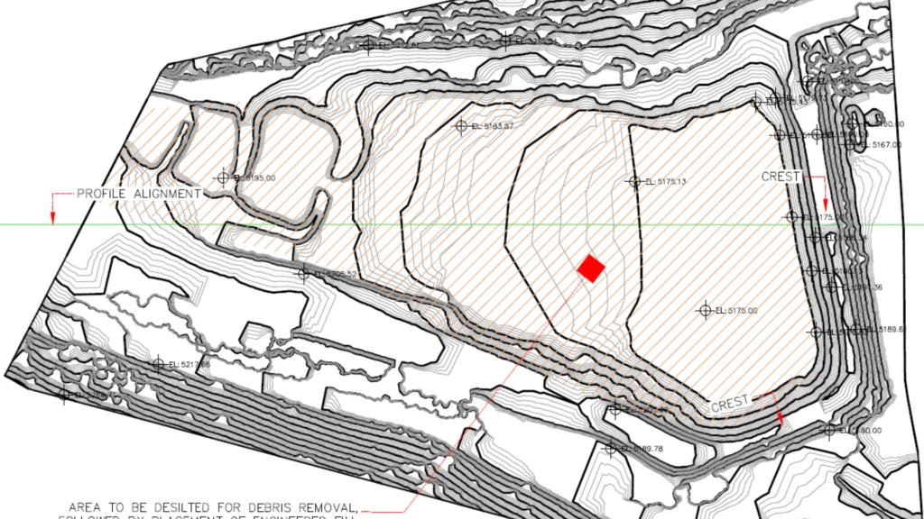
Cut and Fill Analysis
Ensure your bids are highly accurate. We use proprietary aerial analytics as a starting point so your bid is accurate especially early on when you can’t always fly out to the project site. Take the guess work out of it so you don’t regret over or underbidding on a project.
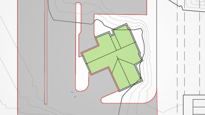
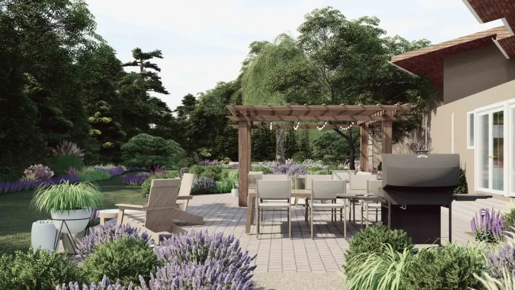
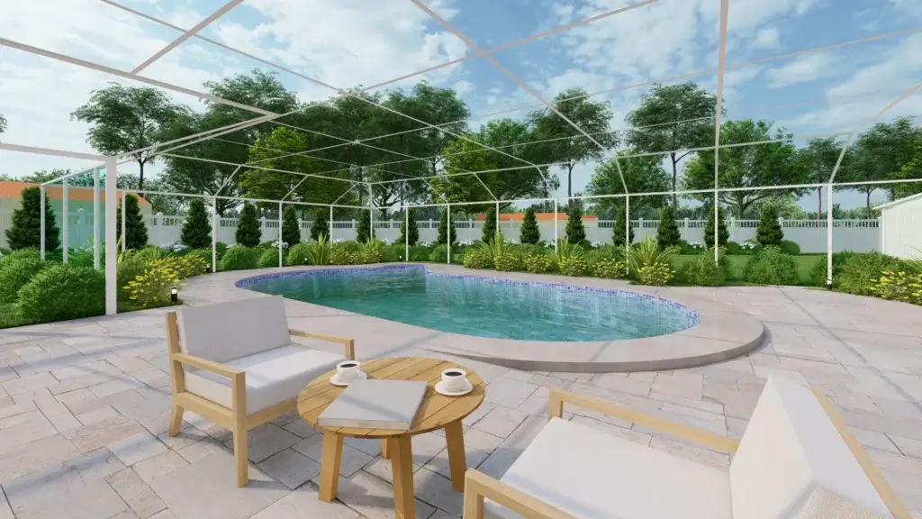
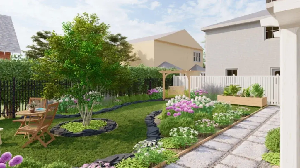
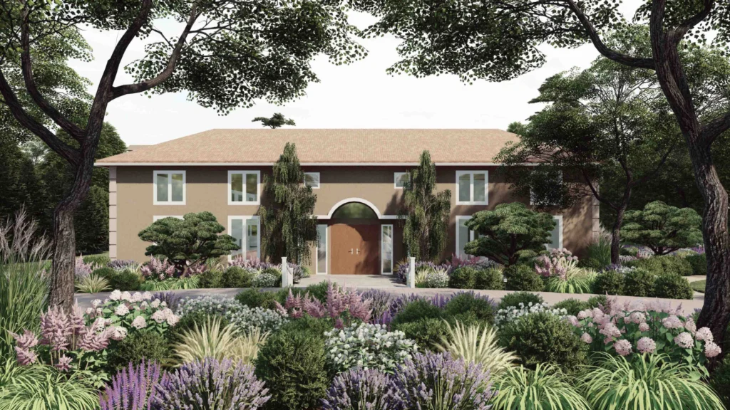
Win jobs fasters by leveraging your extra team in a pinch. Our Landscape Designers have experience in 3D digital representations of outdoor spaces, such as gardens, parks, terrains, and urban environments.
Stop doing tasks you can outsource.
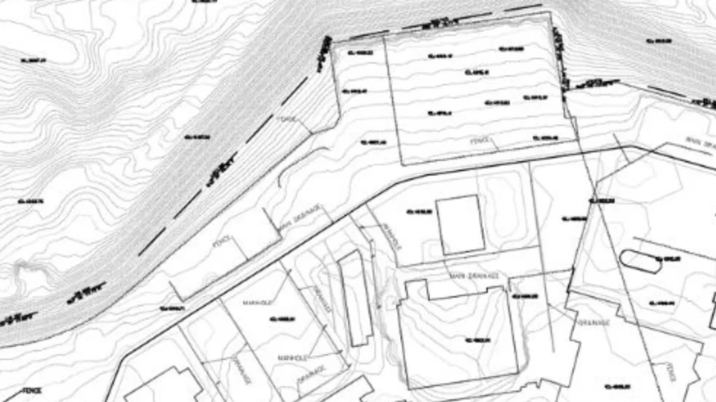
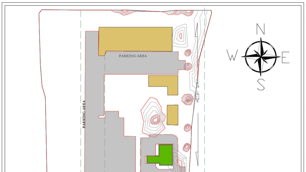
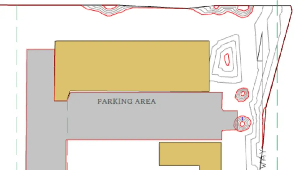
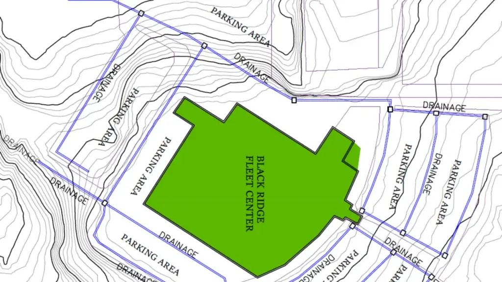
Contour Maps
Instead of spending your whole day tracking down the right data points from various opensource sites where the data is super outdated, just ping us and we can do it for you with better data and a fast turnaround time.
Tired of lukewarm vendors?
By partnering with us, you get exclusive focus on your properties since we only have a certain amount of openings annually and tailored data analytics to push the lines of innovation.
Before launching the company, the owner provided GIS (geospatial) and 3D modeling for powerhouse AEC firms below. That same level of expertise to multi-billion dollar brands is what you get for your property reports and maintenance services.